

Political and Physical Map of the Atlas Mountains Region
The Atlas Mountains form one of the most important mountain systems in North Africa, stretching across Morocco, Algeria, and Tunisia. This vast range influences climate, settlement patterns, and economic activities across the region. A detailed understanding of the Atlas Mountains map helps in visualizing how these mountains divide landscapes, connect cultures, and shape national boundaries.
Rising from the Atlantic coast of Morocco and extending toward the Tunisian plateau, the Atlas Mountains create a natural barrier between the Mediterranean and the Sahara Desert. Because of this unique position, the region has both strategic political significance and diverse physical characteristics that are closely tied to geography.
Political Map of the Atlas Mountains Region
The political structure of the Atlas region is closely linked to the countries it spans. When examining an Atlas Mountains map, it becomes clear that the mountain system primarily lies within Morocco, while extending into parts of Algeria and Tunisia.
In Morocco, the Atlas Mountains dominate the interior landscape, dividing the country into coastal and desert-facing zones. The High Atlas, Middle Atlas, and Anti-Atlas ranges are entirely within Moroccan territory, making the country the central political authority over most of the mountain system. This control influences resource management, tourism development, and rural settlement policies.
In Algeria, the Tell Atlas and Saharan Atlas extend across northern regions. These subranges play an important role in defining administrative divisions and population distribution. Cities are mostly concentrated north of the mountains, while the southern areas transition toward desert terrain. A close look at an atlas mountains map shows how these political boundaries are shaped by elevation and accessibility.
Tunisia contains the easternmost extensions of the Atlas system, though the mountains here are lower and less continuous. Still, they influence local governance and land use planning, particularly in rural and agricultural areas. Across all three countries, the Atlas Mountains serve as both a natural divider and a unifying geographic feature that shapes regional cooperation and environmental policy.
Physical Map and Landforms
The physical characteristics of the Atlas Mountains are highly diverse, including snow-capped peaks, fertile valleys, rocky plateaus, and desert edges. On a detailed atlas mountains map, elevation changes are clearly visible, especially in the High Atlas region, where peaks exceed 4,000 meters.
The High Atlas is the most dramatic section, featuring rugged terrain and deep valleys carved by rivers over millions of years. This region is home to Mount Toubkal, the highest peak in North Africa. The Middle Atlas, by contrast, is more forested and receives higher rainfall, making it an important ecological zone. The Anti-Atlas is older and more eroded, consisting of rocky outcrops and arid landscapes.
The Tell Atlas and Saharan Atlas in Algeria form a double mountain chain that influences rainfall distribution. Moist air from the Mediterranean is trapped by these ranges, creating fertile northern plains while leaving southern areas drier. This contrast is clearly represented when studying an atlas mountains map, where vegetation patterns and elevation shifts are strongly linked.
Climate and Natural Environment
The Atlas Mountains play a crucial role in shaping North Africa’s climate. They act as a barrier between humid coastal air and the dry Sahara Desert. As a result, northern slopes receive significantly more rainfall than southern slopes, leading to sharp environmental contrasts within short distances.
Snowfall is common in higher elevations during winter, particularly in the High Atlas and parts of the Tell Atlas. This seasonal snow contributes to river systems that support agriculture in surrounding valleys. Forests of cedar, pine, and oak are found in the Middle Atlas, while desert shrubs dominate lower and southern regions.
The variation in ecosystems is one of the most striking features visible on an atlas mountains map, where vegetation zones shift rapidly with altitude. This environmental diversity supports a wide range of wildlife, including Barbary macaques, foxes, and numerous bird species.
Human Settlement and Economic Activity
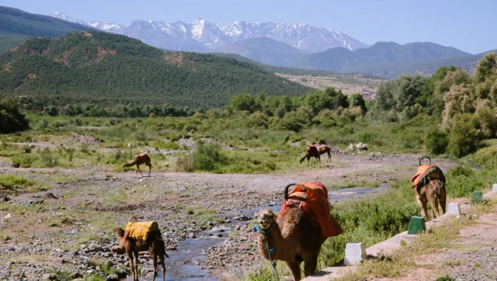
Human settlement in the Atlas region is strongly influenced by terrain and climate. Villages are often located in valleys or on mountain slopes where water is available and agriculture is possible. Traditional Berber (Amazigh) communities have lived in these regions for centuries, adapting their lifestyles to the mountainous environment.
Agriculture remains a key economic activity, with crops such as olives, barley, wheat, and fruits grown in irrigated valleys. In Morocco, tourism is also a major industry, as travelers visit the mountains for trekking, skiing, and cultural experiences. These patterns are easier to understand when studying an atlas mountains map, which highlights the relationship between terrain and human activity.
Mining is another important sector, particularly in Morocco, where phosphate and other minerals are extracted from mountainous regions. Roads and infrastructure development often follow natural passes through the mountains, connecting inland communities with coastal cities.
Cultural and Strategic Importance
The Atlas Mountains have long served as both a cultural refuge and a strategic barrier. Historically, they provided protection for indigenous Amazigh populations, allowing them to preserve language and traditions. Even today, many rural communities maintain distinct cultural identities shaped by isolation and geography.
From a strategic perspective, the mountains influence transportation routes and military planning. Passes through the ranges have historically been used for trade between sub-Saharan Africa and Mediterranean civilizations. Modern infrastructure still relies on these natural corridors.
Understanding the Atlas Mountains map helps explain how geography continues to influence political stability, economic development, and cultural diversity across North Africa.
Conclusion
The Atlas Mountains are more than just a physical landmark—they are a defining feature of North African geography. Through both political and physical perspectives, they shape how people live, govern, and interact across Morocco, Algeria, and Tunisia. By studying the Atlas Mountains map, one can clearly see how elevation, climate, and political boundaries are deeply interconnected, forming one of the most complex and fascinating regions in the world.